
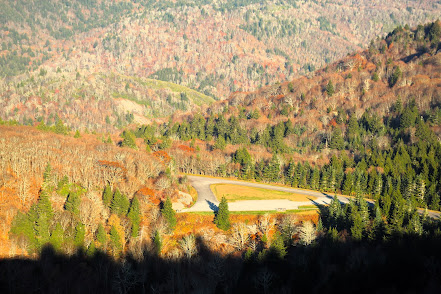
Less than two weeks ago, Tropical Storm Fred hit the Western North Carolina Region hard. My town of Canton was flooded and the bucolic outlying community of Cruso mourns the death of six people and dozens of homes swept away or destroyed. While the human effects of the storm have been well publicized, the devastation to Pisgah National Forest, Nantahala National Forest and other outdoor destinations in the area was also catastrophic. Trails are buried beneath landslides and downed trees, bridges have been destroyed, and creeks and rivers have changed course, erasing familiar destinations such as Skinny Dip Falls and Mease Hole. The above picture (courtesy of US Forest Service) shows popular Sliding Rock during the event. Because of this, we have visited Eastern Tennessee on the other side of the mountains for hikes the past two weekends. (Central Tennessee was hit by devastating floods last weekend.)

The Old Settler's Trail (OST) in GSMNP runs from Greenbrier to Maddron Bald Trail near Cosby and passes through an area that was home to many communities before the park. Along it's length you may view walls and chimneys left from homesteads and access many old cemeteries. The trail is 16 miles one way so a shuttle would be needed to cover the entire route in a day hike. However, there are many old paths and manways that connect down to 321 (East Parkway) which enable section hikes. And for me, they provide added exploration. For today's hike, I parked at the access road to Lindsey Town cemetery, just opposite Tunis Road. (Note, the road is gated a short distance down and narrow. Be sure never to block any gates as they provide emergency access.)

If you would only stop to live
One moment at a time
You would I think, be startled by
The things that you would find
like scents you never noticed
And many subtle sounds*
I try to get on trails as early as possible to enjoy the solitude and to escape the heat in the summer. Walking up the grassy road, I first noticed the bits of meadows to the sides that showed off late summer wildflowers. I heard the the plaintive single note song a solitary bird kept repeating. I was present enough to see the amazing spider webs and avoid walking through most of them. As I neared the cemetery, a wild boar scampered across the road about 30 yards ahead. Just past this point, the road expanded into a big green circle and I saw two green paths departing ahead. I took the one to the left assuming that it led to the cemetery and the other led on to the Old Settler's Trail.


As I always do, I spent time reflecting on the lives that the stones represented. Most of them lived a hard life and many of them died young. Infant graves are always numerous in these old burial grounds. And in walking around, I found that I had assumed wrong. The path I chose did go to the cemetery but so did the other one. It stopped at a series of steps into the middle, likely the official entrance. So I moseyed back to the circle and found a smaller path that led down through a rhododendron tunnel. The fungus were plentiful so I hope Miss Piggy had a good breakfast. Just a short distance down, the trail dips down to cross Snakefeeder Branch and comes up at the junction of the Old Settler's Trail. There is a sign marking the OST here to help find your way back if you are not using GPS.


I chose to turn right (towards Greenbrier) as I had recently explored the Soak Ash area to the left. Along this section of the trail. there are some small remains of chimneys and mounds where the chimneys have toppled. Often at homesites, you will see an assemblage metal bits, broken glass and bottles, and pieces of dishes or pottery that have been gathered together by various hikers over time. It's even more enjoyable, though, when you scout around the area and find a small bit of your own to add to the display.

The OST from where I hit it gradually ascended, slightly at first but then more moderately until it dipped down to the crossing of Copeland Creek. There was a prominent manway going to the right, down along Copeland Creek. On these exploratory hikes, I usually do not have a destination; I go where the spirit sends me. And today, the spirit said see what's down there. Homesites in the old communities that were in this area were along the creeks that flowed down from the mountains, eventually joining the Little Pigeon River. This path led steeply down for a while with no evidence of any fields or homesites. Finally, I reached a mound of rocks and metal parts from a chimney, and a short distance later a small cemetery with only rough river stones for markers.

Consulting my topo map, I found that this was Sizemore cemetery and it appeared that the trail would continue on to another cemetery further down. From here, the trail narrowed and crossed Copeland Creek several times, but it was still easy to follow. Coming to the rubble of another homesite, I scouted around seeing many bits of glass and dishes. The trail began getting muddy at this point and hard to follow. I came out to a sizeable meadow with no clear Idea where the trail was. I began crossing through the field and found it was swampy. At this point, three branches of the Copeland creek were converging so I decided the best idea was to make my way across to the farthest bank and follow it down to the next cemetery. Sure enough, when I crossed over that, there was a nice trail running down to Mullins Cemetery. This one was bigger with a few modern headstones but was in disrepair.


Once again, I consulted my topo map and saw Rector Cemetery not far away. Although it was on a completely different branch of Copeland Creek, I knew that there are a labyrinth of old roads and paths throughout that area and theorized there might be a way to reach it from where I was. I further theorized (not assumed) that there would likely be a manway following that branch up to E. Parkway a short distance from where I parked. Scouting "above" Mullins Cemetery, I found a pathway (or maybe drainage) that headed up a hill in that direction so spirit guided me onwards. I was reassured when I saw a somewhat recent clean sawed off branch that I truly was on a trail going somewhere. As it widened I checked my location and saw it was going right where I wanted. Jubilation!

Then I hit an area with a profusion of large and small downfall. I tried to climb through and skirt around, checking the topo for guidance but could not find it. Eventually, my searching led me into the tangled world of laurel and sticker vines that is the arch nemesis of bushwhacking. There comes a point on some of these exploration hikes where I realize I have passed the point of no return and have to keep going forward. After another consultation with the topo map, I gave up on the search for the elusive path I was on and descended down to branch that Rector Cemetery was on. I was quite happy to see a serviceable path following down the other side of the river. As it got closer to the cemetery it also was better developed so I assumed that the way to E. Parkway past Rector Cemetery should be easy. When I first glimpsed the cemetery from the trail, I was happy to realize I had made a correct assumption. Rector Cemetery was a big one with modern headstones and had been recently decorated. A grassy road leads down to it from 321.


I was somewhat surprised to find the grave indicating a person had drowned in a flood, though it was always a danger with homesites right along creeks. Many people enjoy the restored and "Williamsburgized" buildings in Cades Cove. I prefer finding the remnants as nature takes over. The faint inscriptions on old tombstones brings to mind impermanence. We live and we die. Nothing ever stays the same. Even these Appalachian Mountains--elders among mountain ranges--are constantly morphing, though on a timescale we don't comprehend. So I try to continue to live one moment at a time.

*Songwriters: Ernest Anastasio / Scott Herman / Tom Marshall
Scents and Subtle Sounds lyrics © Downtown Music Publishing


No comments:
Post a Comment