
Sadly, I only learned about Mike Maples on his passing. Mike was a pillar of the Tennessee Smokies hiking community. He spent most of his adult life as a guide, historian, genealogist, folklorist, and avid hiker. He wrote several books that gave life to the folks who lived and died in areas prior to the formation of Great Smoky Mountain National Park. Armed with his hand drawn map and vague directions, I attempted to find some of the lost history of a region of Cosby—one of the more secluded sections of GSMNP. I would term this a cautionary tale.


I began this expedition at the Gilliland Cemetery. The earliest recorded burials at this cemetery were John Gilliland and his wife Elcie (O’Dell) Gilliland who both died after 1880. These names represent the earliest white settlers in the area. John’s grandfather—also named John Gilliland—was a hero of the battle of King’s Mountain in the Revolutionary War and is credited with being the father of Newport, TN for donating 50 acres of land for a courthouse and town square. Samuel Odell (likely Elcie’s grandfather) is believed to be the first to settle in the Cosby Creek valley. (He spelled iT Crobey’s Creek in his will. I couldn’t determine if that was the original name or just a product of the inconsistent spelling that was common then.)

If you have passed the road leading to Gilliland Cemetery, you have doubtlessly caught a glimpse of the abandoned house above. I have encountered two references to it being the Gilliland-O’Dell house. Was this, in fact, John and Elcie’s home? It looks like it was an impressive home and one wonders why it would be abandoned.

From the cemetery, I followed an easy trail that led to a branch of the creek and the first sign of a homestead: a partially intact chimney. Most of the former homesites in GSMNP can be discerned by remnants of chimneys as the remainder of the house would have been wood. Once alerted to the location of a house, searching may then reveal metal parts of stoves or bedframes.

My next destination was a solitary grave a couple of miles east. My GPS/Topographic map showed me where it was and I was certain that Mike Maples descriptions of the route and hand drawn map would get me there. Well… Any semblance of a path along the route he showed quickly disappeared. I saw an open way up the ridge and daylight ahead. Perhaps this was where he found open fields and many crisscrossing roads. As I ascended I realized it was just the spine of a ridge but there is usually a type of path along them and I could tell by the topographic map that this ridge led to the grave. The further I went, though, the thicker the rhododendron got until it was impassable. At this point, I realized I had to make my way back down to the creek branch. This involved swimming through thickets of rhododendron, laurel and sticker bushes that were also loaded with snow. Finally, I again reached the haven of the creek soaked and scratched.

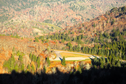
Here there was again a semblance of a trail and I followed it until the land to the left did open up into what was probably fields once. I could also discern what had been roads. If you have ever hiked one of the major official trails in the Smokies in the spring, you know that deadfall from winter storms can render them obstructed until those nice volunteers come to do trail maintenance. Then, imagine reading about conditions from a few years back concerning roads that have not been maintained in many decades. At least it was open enough to make some progress.

Mike’s sketchy map has no scale or indications of distance so trying to match it up with my topographic map was a challenge. I could see that I was getting close to a spot where I had to turn left and start up the knoll where the grave was. But where? I saw what might have been an old road heading up that way so I tried it and found that it petered out into rhododendron hell. Since I had made progress up the knoll, I decided to bushwhack east until I hit the trail on his map. The rhododendron here was mature and I was able to traverse it over a couple of gullies, looking to see if one had a clear path upwards. The third one looked promising and there I spotted trail blazes! (This is not allowed in the Smokies). I followed them though I discovered they led through a thick, nasty section of wretchedness that finally reached a clearing in a saddle below the top of the knoll. From there I was able to find the well-developed trail to the top. Upon re-reading Mike’s hike description, he notes that used to be a good trail but now is UGLY and tells of a much easier way that I used upon leaving. Who likes easy?

In a beautiful clearing on the top of that knoll lies the solitary grave of O. M. Caton, son of Greenberry Caton and Martha Cordelia (Lindsey) Caton. If you view a map of Cosby, you will notice that Lindsey Gap Road is just a stone’s throw from Catons Grove Road. Rev. Thomas R. Caton (grandfather to O.M.) was the founder and builder of Catons Grove Methodist Church. But, alas O.M. could not be buried in that church graveyard as he had committed suicide, hanging himself in his barn at the young age of 25. So now his gravestone enjoys a beautiful but lonely spot.

Returning down the path, I followed Mike’s easy directions and went down the opposite side that was a wide-open road leading down to a small creek with a homesite on the other side. There were remnants of a road that crossed this small branch. The homesite had ruins of the chimney but also some metal artifacts. I decided at this point to continue east to another old road that Mike reported was still traversable that led to route 32 two miles from the Gilliland Cemetery Road. There were signs of a bridge once crossing Robinson creek but I had to rock hop. More remnants of homesites were evident in this section and was much closer to the description of open fields and old road.

Near the end of my hike I explored one other area that had some metal artifacts. Some appeared to be sheet metal parts of cars. There were also some ceramic pieces. And I saw these articles hanging in a tree and wondered if they could be barrel rings from a still. Cosby was known as “the moonshine capital of the world” back then and the hollows and rugged terrain in this area was the perfect setting.

If this history sounds interesting but the hike description sounds psychotic, there is an easier way of exploring this section by hiking the Lower Mount Cammerer Trail. You will find many old walls, chimney remnants, a side path to a cemetery and even a fairly intact old car not far off the trail if you know where to look.


No comments:
Post a Comment