Of the "gateway" communities for Great Smoky Mountain National Park, Bryson City is the one that I adore. Personally, I find Pigeon Forge, Gatlinburg, Cherokee, and Maggie Valley being full of congestion, commercialism and kitsch. Bryson City, on the other hand, has retained it's small southern town charm while still hosting businesses that cater to visitors to the Smokies. Perhaps the reason is that Bryson City does not attract the drive-through tourist. The roads into the national park from Bryson City go a short distance in and terminate. To enjoy the park, people must exit their cars and explore by hiking or backpacking, horseback riding, even tubing in Deep Creek. Additionally, the town is home to the Great Smoky Mountain Railroad. Although it does not quite enter the park, riders can enjoy a scenic trip through the Nantahala Gorge. 
 At 3.2 miles, the Thomas Divide trail turns right on a single track that will continue up to a high point on Newfound Gap Road. The old roadbed becomes the Indian Creek Motor Trail and I wondered how long it had been since cars were allowed to travel it. The trail descends steeply and crosses several tributaries that were mere trickles on this day. As I progressed into the valley, though, the roar of the creeks below grew and I began to wonder if a wet crossing was in my future. I have hiked the Indian Creek trail previously and knew that it had bridges being also another old roadbed. Looking at my topo I noticed that I would be on Deeplow Gap for about half a mile prior to that trail and it appeared to cross the creek several times. Well, not knowing is part of the adventure. Indian Creek Motor Trail ended at Deeplow Gap trail. As before, to the right Deeplow gap went up on a single track to eventually meet Mingus Creek trail. Continuing bearing left on the old roadbed, I was now on the Deeplow Gap Trail which followed along the scenic cascades of Geroges Branch. With still dry feet, I arrived at the Indian Creek Trail.

I tried to arrive for my Thanksgiving morning hike for sunrise but the area was thickly blanketed in fog. This made for a perfect contemplative start as I felt totally isolated. I heard no sound other than the drips of the trees shaking off yesterday's rain and the occasional echo of woodpeckers tapping out their breakfast request. I began on the Thomas Divide trail which is an old road bed in this section. A scant 100 yards up the trail, I veered off to pay my respects to the first of three cemeteries I visited on this hike. My topo map identifies it as Wiggins Cemetery but I know there is also a cemetery for several of the Wiggins Children off of Deep Creek Trail. The trail ascends steadily, gaining about 1300 feet in 3 miles along the ridge that serves as the de facto park boundary between Deep Creek and Cherokee. The only other soul I saw was an intrepid spider who had managed to construct a big web across the wide trail.


This area was originally inhabited by the Cherokee (Aniyvwiyaʔi). As European settlers began to make contact and infringe on their land. The Cherokee made strides to "Europeanize" to be accepted. They developed a written language, many adopted Christianity, they developed democratic forms of governance, built and lived in houses and some even owned slaves. These efforts did not protect them. When whites continued to invade their federally recognized land for gold and farmland, rather than enforce the treaties they signed, Andrew Jackson had the people moved west to Oklahoma on what became known as the "Trail of Tears." This history and how the Eastern Band of Cherokee managed to remain can be read about in Charles Frazier's excellent fictionalized fact novel "Thirteen Moons"

A short distance up Indian Creek trail, I veered off to the left on a trail that took me up to the intriguing Queen/Styles cemetery. One of the odd sights there was the strangest tombstone I had ever come across. The writing protrudes and is backwards. I queried Hiking the Smokies fb page and was quickly answered by an amazing blog post detailing it. I share the link here so you can read it and also want to acknowledge some more history of the area I will write about comes from this source.

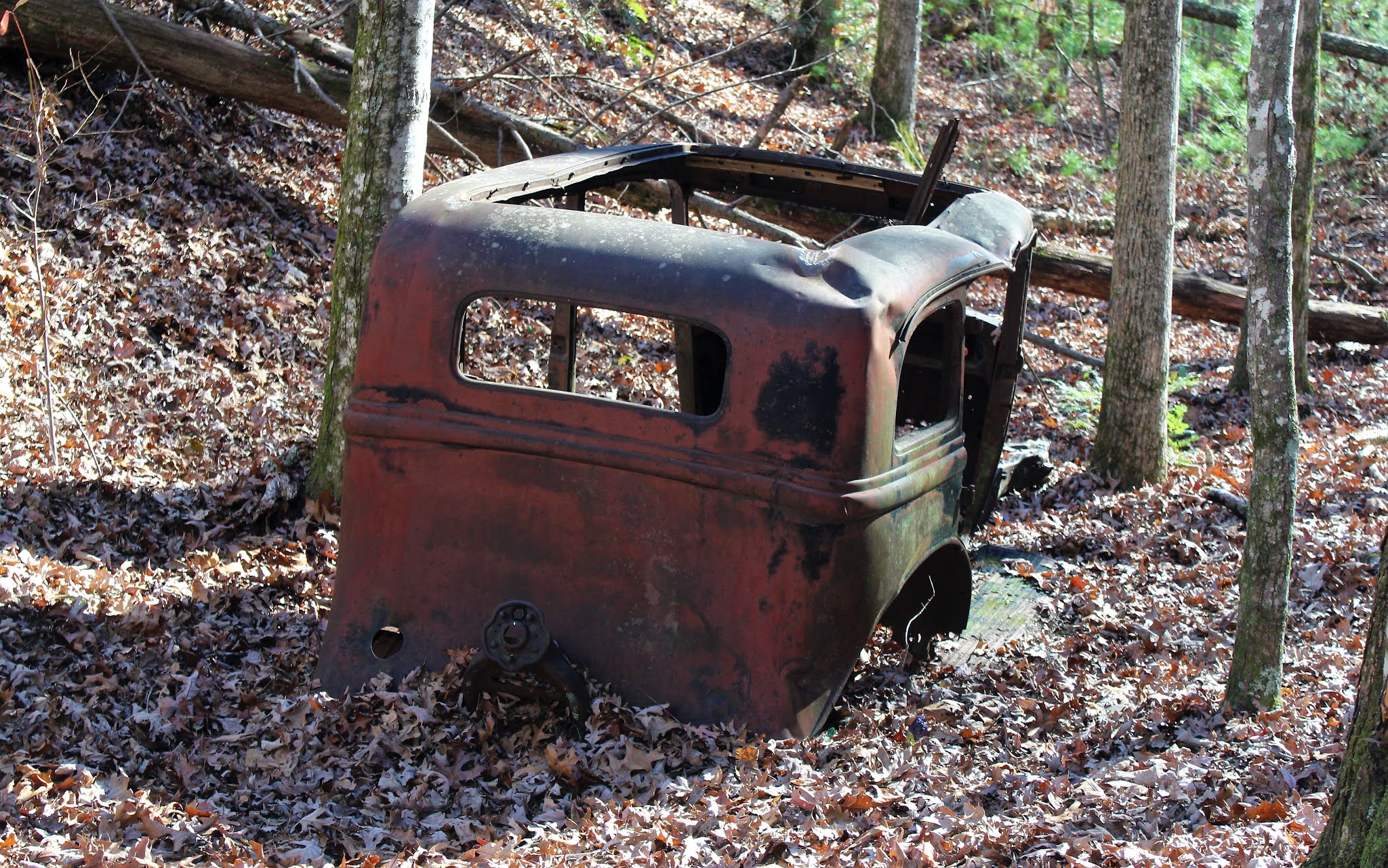
Leaving the cemetery, I returned to my journey down Indian Creek Trail and began to wonder about the settlers who lived here after the Cherokee removal. Approximately 30 families made their homes there. They had a schoolhouse and church (Baptist, of course)). At one spot, I stopped to view land that obviously had been cleared for a farmstead and wondered what there life was like and what they might have been doing on a Thanksgiving day around 1900. (Turns out that area was home to Alfred and Louisa Parris who importantly had a grist mill on their property). As I was lost in my reveries, I heard a snort and the sound of a running animal about 10 feet behind me. I turned to see a large deer that had been right off the other side of the road putting some distance between us.

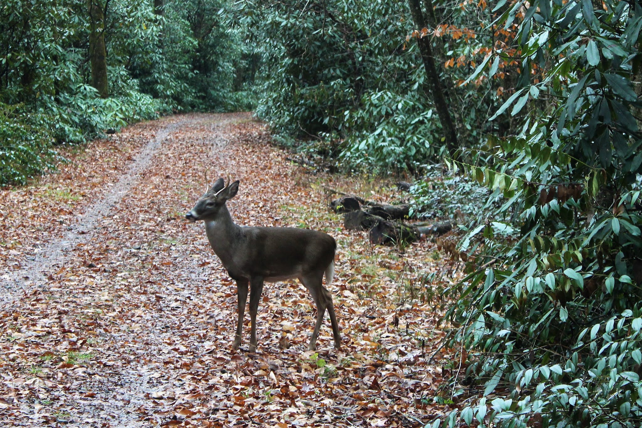
A short while later, I arrived at the short side trail to the right that led to Laney Cemetery. This was either the oldest or poorest of the three cemeteries. There was only one true headstone with an inscription. The majority of graves were marked by anonymous fieldstones. I made my way back down the side path and turning back onto Indian Creek Trail, I was met by an adorable young buck. I stood still taking pictures and he was undaunted, curious enough to move closer to me before sauntering off.
I had a short distance to reach Stone Pile Gap trail that would take me back up to Thomas Divide Trail. I once again began to wonder if I was facing a wet crossing, particularly since Indian Creek was well-fed and wide by this point. Relief spread through me like sunshine as a spotted a picturesque log bridge crossing it. I also noticed the trail sign indicated it was mile up to Thomas Divide Trail and remembered the sign up on the ridge saying the trail was 0.9 miles. Sure is funny how those trails are always longer going up then when going down.

The first half of Stone Pile Gap trail, was accompanied by a small tributary that ran along it and often concurrently. I guess I was not destined to escape with dry feet. The trail turns to the left to leave the water and becomes a pastoral track lined with large pine needles that traversed some long switchbacks through a grove of laurel. The trail then winds around some drainages prior to ending at the Thomas Divide Trail. An easy 1.1 mile back down to the trailhead and a bright, sunny day completed my 10.5 mile pre-emptive calorie burning hike. Then, it was home to listen to Alice's Restaurant while cooking the best Thanksgiving dinner ever.