|
| A view of Panthertown Valley from a previous hike. |
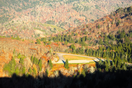
Panthertown Valley--popularly known as "Yosemite of the East"--is a unique enclave in Nantahala National Forest. One can walk on flat sandy trails that follow tannin-tinged streams calmly moving over bedrock or climb one of the prominent rocky knobs that offer incredible views. The area is home to rare flora and fauna. Although no panthers have been spotted in a long time, bears are plentiful and sadly getting acclimated to eating at campsites of careless campers. And there are many exquisite waterfalls.
Those adventurous folks who explored Panthertown in the years following it's purchase by the NC Nature Conservancy and addition to Nantahala were guided either literally or figuratively by a man named Carlton McNeil. Carlton's house was adjacent to what is now the Cold Mountain trailhead and he is responsible for cutting many of the trails that are now official forest service trails, and also many of the unofficial trails that reach falls and other points of interest. Carlton was a self-styled caretaker and guide, and was a ubiquitous presence on the trails until his death in 2007. My hike would follow his trails up Greenland Creek, finally ending at Carlton Falls.

Hiking down Greenland Creek trail (formerly known as Carlton Way), it was only a short distance before I detoured on to one of his unofficial trails to reach Mac's Falls (pictured above). The trail down to these falls show many of the deficiencies of Carlton's trails. He was not a professional and did not concern himself with erosion or sustainability. They are also often twisting, contorted narrow paths that have many low branches to watch out for. But they get you to the beauty spots.

Returning to Greenland Creek Trail, I followed it to it's official terminus at Greenland Creek Falls. (above). One of the stories folks share about Carlton McNeil was that his neighbor had found that this falls was unnamed and named it after his daughter Holly. Carlton responded that the falls were to pretty to be named Holly Falls so he named them after his dog, Cheyenne. Either of those names would have been preferable to me but the US Forest Service has no imagination.This was as far as I got on previous visits because the maps show the trail ending there. Today was the day to see what lay beyond.

Bearing left, a steep trail goes up along the falls. It is popularly used for people to access the shelf between drops of the falls for photo ops. Slick and steep, the trail eventually heads back down a bit to the top of the falls for the above view. It probably would have been safer to get closer but I didn't want to die before I reached Carlton falls. The path winds through rhododendron, laurel, and dog hobble, usually closely paralleling the creek. There are many opportunities to venture out to enjoy picturesque cascades. You will know when you are about half-way to Carlton Falls when you reach the aptly named Halfway Falls. (below)

After another half mile of meandering and ducking under laurel limbs, you will reach Carlton Falls. The base of it is dominated by huge boulders and there is cavern to the left of the lower drop. Unfortunately, it is not possible to get a great shot of both tiers of the fall together. There is a recently downed tree to the right of the lower drop that also detracts from the view at the base.


I climbed over the boulders looking for the "sweet" shot then returned to the trail to ascend up to the base of the second drop. The upper drop of the falls is loaded with character. It drops over multiple steps before becoming a slide under the laurel and rhododendron that line the left side. About half way down the steps, there is a large boulder that arches. A section of the waterfall sweeps down behind and underneath of it. This was a fitting location to relax with my lunch before the return trek.

My first time exploring Panthertown Valley was with my hiking group. I remember us spending a good chunk of our time pouring over the crude map we had. My impression then was of a vast, foreboding wilderness that I was likely to get lost in. So much has changed since then. Trails are blazed and marked at all intersections. Campsites have propagated like rabbits in Australia and Schoolhouse falls at the other end of Greenland Creek is a crowded tourist attraction. I had the latest trail map on my phone with GPS tracking that showed where I was at all times. It seems so much smaller and tamer.
Yet, while the beauty of the area transcends the crowds and improvements, the truth is the land there hasn't been a wilderness for a long time. The valley was heavily logged in the 20's and 30's. Fires subsequently cleared large swaths. There is a section of pine forest that is a result of an abandoned plan for a Christmas tree farm. During the brief time Duke power owned it, they put a high tension wire right of way through. We can only celebrate that proposals to turn it into another private resort never came to fruition. And we can be thankful that Carlton McNeil's love for Panthertown Valley made the wonders accessible today.